Latest update: 13. July, 2011
Remark: in May/June/July 2011, several street/place names have been changed, and the names of some stops were modified. Thus, you might find different names in your tourist guides/maps than on the vehicles/signs. The changes on tram routes 4/6 were (old -> new):
Moszkva tér -> Széll Kálmán tér, Baross utca -> Harminckettesek tere, Üllői út -> Corvin-negyed, Fehérvári út -> Újbuda-központ
Moszkva tér (Moscow square) is the busiest public transportation node in Buda. Basically this is where the trams and buses coming from the Buda hills meet the Grand Boulevard routes, and the M2 metro line, which acts as a direct link into the city center. The triangle-shaped kettle, where the 1st, 2nd and 12th district meets, was not always a square. Although the first horse tram service (which later became tram route 58) of Buda already passed nearby in 1869, the place became a junction only in 1898, when the short side-line to Déli pályaudvar (Southern station) was connected to the "Inner Buda circle" (consisting of Krisztina körút and Attila út), resulting in the route that now is served by tram line 18.
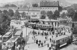
Picture to the left: a weekend
peek in the 1920's. To the left is Krisztina körút, to the right
Szilágyi
Erzsébet fasor.
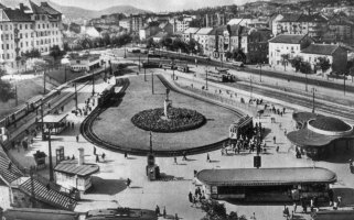
To the right: the whole
square became one big tram juction in 1942 (photographed here in the 1950's).
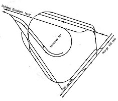
The importance of the place grew as the through tram traffic was regorganised in the late 1910's. Until that point, the routes coming from Hűvösvölgy (today's route 61) and Zugliget only passed through here, and continued their way into the inner city. From then on the majority of the inner city routes only came up to here, and the passengers had had to change for the outbound "mountain routes" starting from a reversing loop built at the junction of Krisztina körút and Szilágyi Erzsébet fasor. This is what you see on the image above to the left.
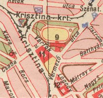
To the left: tennis court
and winding tracks in 1925.
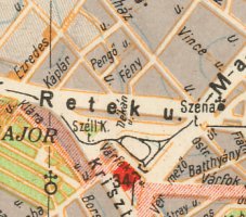
To the right: straight connection
via the tunnel under Várfok utca and a "reversing loop inside a
reversing loop" in 1942
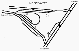
In the late 1930's the tennis court which occupied much of the area of today's Moszkva tér was torn down, and a direct - but unelectrified - railway connection was built between Margit körút and Déli pályaudvar via Krisztina körút. This direct link - part of the "Right Riverside Circle Railroad", a freight train route incorporating tracks of the tram and suburban railway network - featured a tunnel, which is still used. In the following years the rest of the square was turned into a gigantic junction with a reversing loop inside a "roundabout reversing loop". The tracks in the railway tunnel were also electrified and used by the trams from then on. The result was pretty much what you can still see today. The place was named Széll Kálmán tér after former prime minister Kálmán Széll.
Of course there have been a couple of changes since 1942. For example they've shrank the reversing loop of route 56 (and 58) when the metro station was built, and they've also changed the track layout a few times. Until 1989 every route - except route 61 since the mid-seventies - went around in the larger reversing loop around the square, now they all have stub termini or pass through direct tracks.
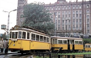
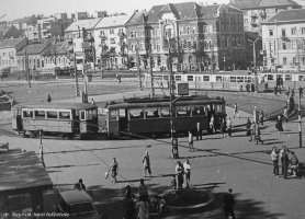
Two-axle tram sets using
the inner (smaller) reversing loop in the 1970's (photos by Tim Boric and
dr. Jenő Sevcsik).
As for tram services, many of them have vanished during the decades. Route 58 (Moszkva tér - Zugliget) is just a memory now, just like route 63 (Szent János kórház - Nagyvárad tér via Szabadság híd and Üllői út) or route 44 (Moszkva tér - Rákospatak via Erzsébet híd, Rákóczi út and Thököly út). By the way, the name of the square was changed to Moszkva tér in 1951.
![]()
The transportation highlights of Moszkva tér are
The terminus of
route 4 and 6
The metro station
The terminus of
route 18
Route 59 and 61 passing
through the square
Here's a hybrid
satellite/map view of the square at Google Maps:
View
Larger Map
You can clearly make out the trams...
![]()
Tram routes 4 and 6 - generally known as
the "Nagykörút (Grand Boulevard) routes" - reverse at a two-track
stub terminus with a scissors crossover in the middle of it. Trams arrive
from the Grand Boulevard via Margit körút. First they let passengers
alight, then they go over to the stub tracks. Normally they must not take
passengers past the alighting stop, but sometimes they do, because this
way the next tram may also enter the terminus. The driver changes ends,
and then pulls into the "boarding stop", where passengers get on.
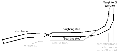
There's also a connecting
track starting at the northern entrance, heading for Szilágyi Erzsébet
fasor via the tracks of route 56. This track is also used for storing
reserve/broken trams. The entrance/exit of the spare track is done via
a single skip.
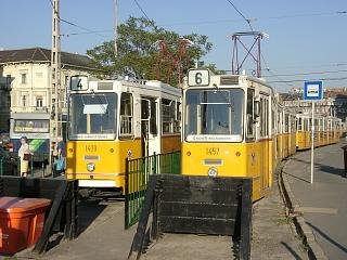
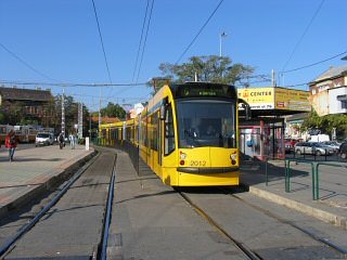
The stub end of the terminus
of route 4/6 seen from its two ends, once yet with Ganz articulated cars,
and then with a Combino.
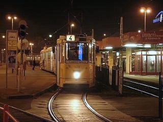
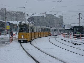
To the left: a double-set
of Ganz articulated trams is about to depart. To the right: a similar set
on route 6 leaving the terminus.
-> Link to the Grand Boulevard routes
![]()
The panorama of Moszkva tér is dominated by the ugly escalator hall of the metro station built in 1972 in a style that was typical for the communist era's soviet architecture and not really typical for Budapest (fortunately). By the way, they say it was built without a building permit :) There's a chance that when the square gets restructured (there are plans, but no money), this palmetto-shaped thing will dissapear.
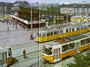
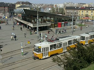
Not much has changed: a
picture from the 1980's, and (almost) the same sight in 2002.
![]()
Route 59 and 61 have had their termini on the the eastern side of the square, now it's used by tram 18. It arrives from south via the tunnel, and although the track continues towards Margit körút, it reverses before it would reach the tracks of route 4 and 6.
Remark: As I stated at the top of this page, the photos show the previous usage of this terminus. By the way, tram 41 also ended here for a few months...
Hint: This can be nicely photographed from above the tunnel!
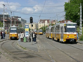
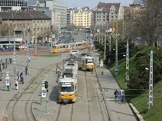
We're now facing north:
the track to the left was used by route 61, while the one in the middle
was used by route 59 until August 2007.
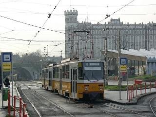
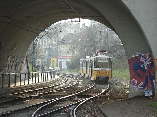
We're facing south-southwest:
the characteristic building in the background is the Postal Palace built
in 1925. On the picture to the right you can see the tunnel with a tram
heading south.
-> Jump to route 18 heading south, joined by 59 and 61
![]()
Tram routes 59 and 61 are passing through Moszkva tér on the southern side since 2008. This is a connection between Szilágyi Erzsébet fasor and the tunnel, with a connection to the Grand Boulevard routes, a crossover switch, plus a reserve track, so it can be exciting for tram photographers.
Remark: As I stated at the top of this page, the photos show the previous usage of this stretch.
Hint: The stop of these routes, located at the foot of a brae can be nicely photographed from the pedestrian flyover bridge over the tracks.
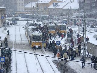
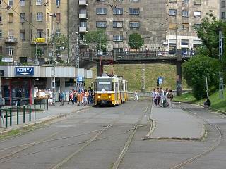
To the left: tram 18 passing
through to north, photographed from the pedestrian floyover. The two other
Tatras to the right were tram 56s on their terminus at the time. To the
right: another photo of route 18 at its northbound stop - note the pedestrian
flyover bridge in the background!
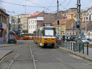
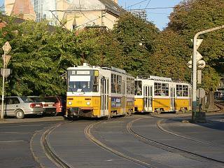
To the left: a tram 18 leaving
its stop here for Szilágyi Erzsébet fasor, just passing the crossover.
To the right: tram 56 arriving
to the square from Szilágyi Erzsébet fasor. This bend can be photographed
nicely early in the morning.
-> Over to route 59 and 61 between Moszkva tér and Szent János kórház/Hűvösvölgy
![]()
Back to the
top
Back
to the opening page
Disclaimer: The author cannot
be held responsible for mistakes, misinterpretations, inaccuracies, inactualities,
etc. on/of these pages, nor for the content of other pages linked in.![]()
Send
a mail to the author
The
author's homepage
